| |||||
| Updated February 14, 2023 | |||||
| 1. Make a Survey Record before Field Work | |||||
|
The manager picks an area where the survey will occur, and makes a new survey record
including the polygon of the area. For example polygon #15:
Getting ready for field work, each member of the crew uses Background Lines and Polygons application to load polygon #15 into the Observer Pro app on their phones: 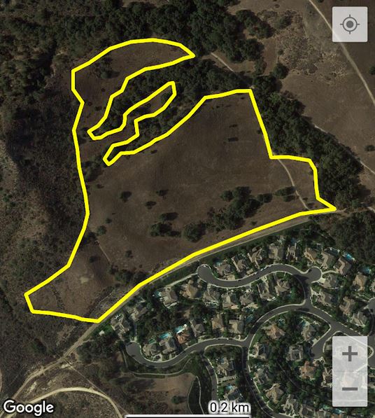
When the crew uploads their observations, they automatically become part of the new survey.
Once field work is complete, the manager edits the new survey record, and checks the observations.
The manager uses PLANT LIST / Update / Add plants from observations
to construct a plant list from the plant names in the observations.
| |||||
| 2. Annual Survey Based on Study Areas | |||||
|
Getting ready for an annual survey of a park, the manager prepares study area polygons.
Each study area is a place inside of the park where weeds are likely to be found,
based on the record of previous years.
For this year's survey, 30 study area polygons were prepared. Data will be collected for this survey over the period of a week. The manager reviews all study area polygons in the Shape Editor: 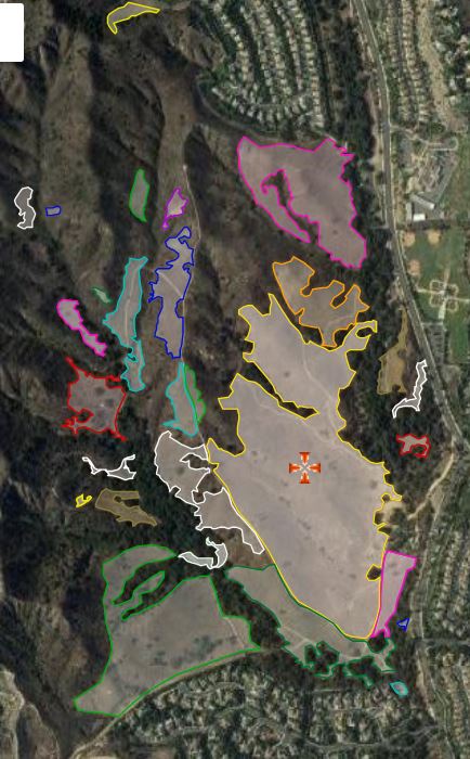
Crew #1 is assigned to look for weeds in study area polygon #15: Each member of Crew #1 uses the Background Lines and Polygons application to load that polygon into the Observer Pro app on their phones:
Over the course of two days, Crew #1 enters 23 observations of weeds. These records are viewable to anyone in the group through the Group Observations application: 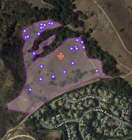
When the data collection period is over and all crews have completed their assignments, the manager makes a survey reocrd to summarize the data collected. First, the manager uses the Shape Editor to combine all of the study area polygons into a multi polygon: 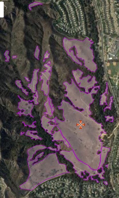
Then the manager uses Survey Entry to make a new survey record, using the multi polygon as the area of the survey. The manager adds all of the observations that were made in the survey area during the data collection period to the survey: 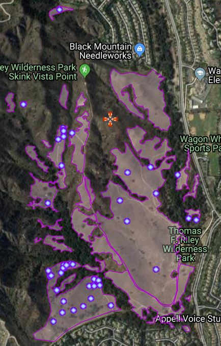
| |||||