| ||||||
|
Updated December 21, 2022
Use the
Background Lines and Polygons
application
to choose which lines and polygons will appear in the Observer Pro phone application.
Selection is on the basis of group -- for each group you are a member of,
you can have a different set of lines and polygons.
Lines and polygons which belong to you but which are not affiliated with a group
will be available in Observer Pro when you choose Independent.
When using Observer Pro in the field, a background line or polygon might help you find a trail or a survey area, particularly if the area is not marked by fences or other physical signs.
|
|
|||||
| Choosing Lines and Polygons | ||||||
|
Check Only my lines and polygons,
or select a group to see all named lines and polygons associated with that group.
Press .
Each line and polygon is tagged with a purpose. You can control how many results you get by choosing one or more purposes. For instance, you might select only those polygons tagged as REGION (management unit).
To choose a line or polygon, click 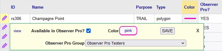 . .
The Observer Pro Group drop down contains all of your groups that appear in Observer Pro.
If you choose the Independent group here (and save it!),
the polygon will appear on maps in Observer Pro when you have selected the Independent group in the phone app.
Coordinating groups do not appear in Observer Pro. If you are a member of a coordinating group, and that group has named lines and polygons associated with it, use the Observer Pro Group drop down to select one of your groups that does appear in the phone app. Then the line or polygon will appear on maps in Observer Pro when you have selected that group in the phone app. |
||||||
| Appearance in Observer Pro | ||||||
|
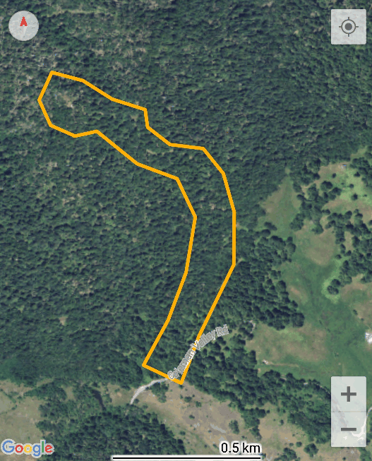
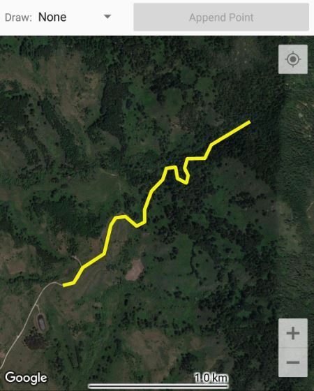
In Observer Pro, when you choose a group, all the background lines and polygons
you chose for that group will appear on the map.
They appear on the map when you are making a new observation, or looking
at past observations on the History / Map screen.
Each line or polygon can be assigned one of several colors.
You might decide that survey areas should be orange, and trail lines should be yellow.
|
||||||
| Compared with Offline Maps | ||||||
|
When the Android version of Observer Pro was first released, it featured offline maps.
Offline maps are a technique for figuring out where you are in the field
when you do not have enough connectvity to pull in a Google map.
Calflora makes some offline maps available for certain areas.
It is possible to make your own offline map, and load it into Android Observer Pro,
if you are comfortable with GIS tools.
However, making an offline map is an exacting and time-consuming process.
Also, offline maps at high zoom levels are huge, which means that you may
only be able to load a few of them if your phone is low on memory.
Ofline maps are not available on the iOS version of Observer Pro.
Background lines and polygons are useful in the same way that offline maps are: they can help you figure out where you are in the field. They are relatively easy to make -- you can draw your own in the Shape Editor, or upload a shape from desktop GIS. They are easy to load onto Observer Pro (both Android and iOS), using this application. |
||||||
|
RELEASE NOTES:
• December, 2022: v. 0.35 Use the Observer Pro Group drop down to specify in which group you want to see the polygon when using Observer Pro. • February, 2021: v. 0.34 This application is now available to any group, not just Weed Manager groups. You can also load lines and polygons that you own, which will be available in Observer Pro when you choose the Independent group. • September, 2019: v. 0.31 | ||||||
 .
Check
.
Check