|
NOTES:
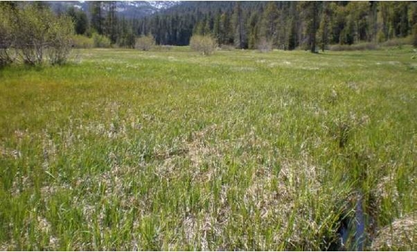
Soil-Plant Relationships (from NRCS ESD R022BI202CA in Lassen Volcanic National Park Soil Survey - access Web Soil Survey https://websoilsurvey.sc.egov.usda.gov/App/HomePage.htm): The soil components associated with this meadow are Terric Haplohemists, Histic Humaquepts, Aquandic Humaquepts, and Aquandic Endoaquepts. These are all very deep, very poorly to somewhat poorly drained soils that formed in alluvium. The wettest part of this meadow fits the criteria for a fen because it has at least 40 cm of organic soil within the upper 80 cm of soil, supports hydrophytic vegetation, and its soil is saturated to the surface for a least one month each year (Cooper and Evan, 2006). Incised ditches and the removal of Lemmon?s willow (Salix lemmonii) and other shrubs have altered the vegetation, threatening the characteristics of the fen. The soil in this part of the meadow are Terric Haplohemists, which have 20 inches of organic muck over a 10 inch ashy silty clay loam textured horizon. The lower horizons have ashy silty loam and ashy silty clay loam textures. The water table fluctuates from 0 to 24 inches during the dry season. The vegetation is dominated by analogue sedge (Carex simulata), Northwest Territory sedge (Carex utriculata), and Nebraska sedge (Carex nebrascensis), along with other hydrophytic vegetation. The Nebraska sedge (Carex nebrascensis) community is found in slightly drier locations surrounding the fen and is associated with the Histic Humaquepts soil component. These soils have 9 inches of organic material over 19 inches of ashy loam textured A and B horizons. The C horizons have extremely cobbly ashy sandy clay loam and very cobbly ashy coarse sandy loam textures. The water table is at the surface in early summer then fluctuates from 10 to 60 inches during the dry season. A mixed sedge and grassland community is found throughout the meadow and is associated with the Aquandic Humaquepts soil component. These soils have 4 inches of ashy mucky peat over an ashy very fine sandy loam textured horizon. The subsurface textures are very gravelly, extremely gravelly, and gravelly ashy sandy loams. The water table is near the surface in early summer and fluctuates from 10 to 60 inches in the dry season. Common plants include widefruit sedge (Carex angustata) and tufted hairgrass (Deschampsia cespitosa). The driest part of the meadow is associated with the Aquandic Endoaquepts soil component. These soils formed in bar deposits. They do not have an organic horizon, due to the aerobic conditions created by these soils as water flows through them. This creates oxygenated conditions for most of the year that allow organic matter to decompose rather than form peat. The surface texture is a gravelly ashy fine sandy loam surface texture. Subsurface textures include ashy very fine sandy loams, ashy loamy fine sand, and ashy loam coarse sand, and gravelly ashy loam coarse sand. This soil has a high percentage of surface gravels and bare ground, compared to the rest of the meadow. Sedges (Carex spp.) and mountain rush (Juncus arcticus ssp. littoralis) provide about 70 percent cover of the vegetation cover.
|