| ||||||
|
Updated May 26, 2021
The Checklist / Survey Search application
lets you search for checklists and surveys and see them on a map.
If you have any questions about using this application, please contact Calflora support. | ||||||
| BASIC USE | ||||||
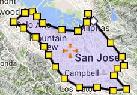
To use the application, click on the
map in an area of interest  ,
zoom in, and press .
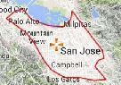
If you want to qualify what observations are returned,
enter some criteria. To see only survey records, choose Method = survey. ,
zoom in, and press .
If you want to qualify what observations are returned,
enter some criteria. To see only survey records, choose Method = survey.
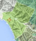
Geographical Extent:
to limit the search to the current map area. |
||||||
Or, press  DRAW A POLYGON
|
|
|
||||
To find all records in a particular park,
press Map Layers
|
|
|||||
| RESULTS | ||||||
|
The results appear simultaneously as points
on the map and in a table below the map.
If you click on a point
editor: Open Survey / Checklist Entry on this record. Illustrated Plant List: Show the plants in this survey in an illustrated plant list.
|
||||||
| SEARCH CRITERIA | ||||||
|
Method: Choose survey to limit the results to survey records.
Choose any to see any kind of survey or checklist.
Natural Status: wild or planted. Group: Seach for all records owned by a particular group. Observer Start Date, End Date: Use one, or the other, or both of these criteria to bracket the Observation Date of records you are interested in. Dates are entered in the format YYYY-MM-DD so that February 20, 2017 is written as 2017-2-20. If you enter 2017-2-20 as the end date, the result will include records that were entered on or before 2017-2-20. If you put the same date in both Start Date and End Date, the results will only include records entered on that date. County Location Name: Some records have useful information in the Location Description field. Enter a short phrase to find any records that contain that phrase in the Location Description field.
| ||||||
| TIPS | ||||||
Searching within a Background Polygon:
There are many background map layers available.
If you select one of the following layers, you can
search within the selected background polygon:
Protected Area (CPAD) Ecoregion Jepson Bioregion CNPS Chapter Zip Code |
in selected area |
|||||
|
RELEASE NOTES:
2022 May Version 0.81 released. 2016 May Version 0.48 released. This application replaces the Checklist Browser.
| ||||||
 on the map,
an InfoWindow opens at the point,
the table scrolls down to
the corresponding record,
and the record is highlighted.
If you click on the purple crayon
on the map,
an InfoWindow opens at the point,
the table scrolls down to
the corresponding record,
and the record is highlighted.
If you click on the purple crayon